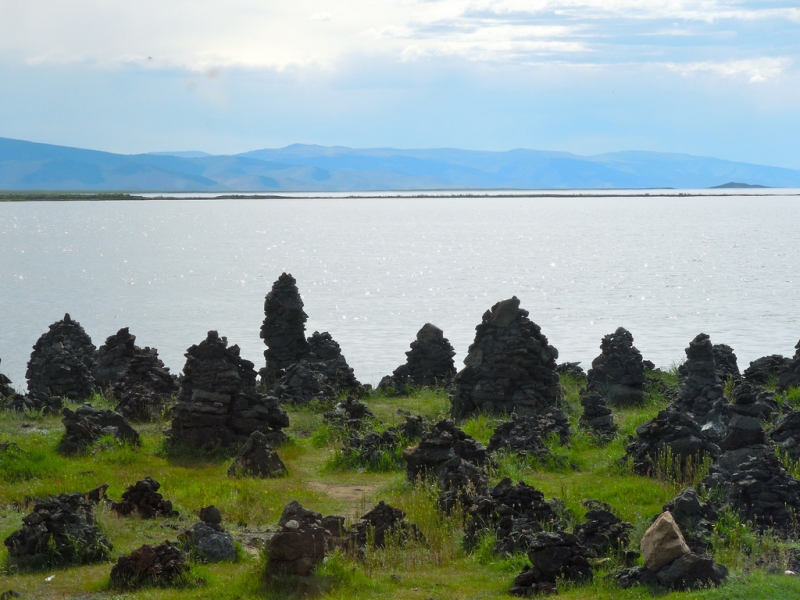
 Naranchuluun
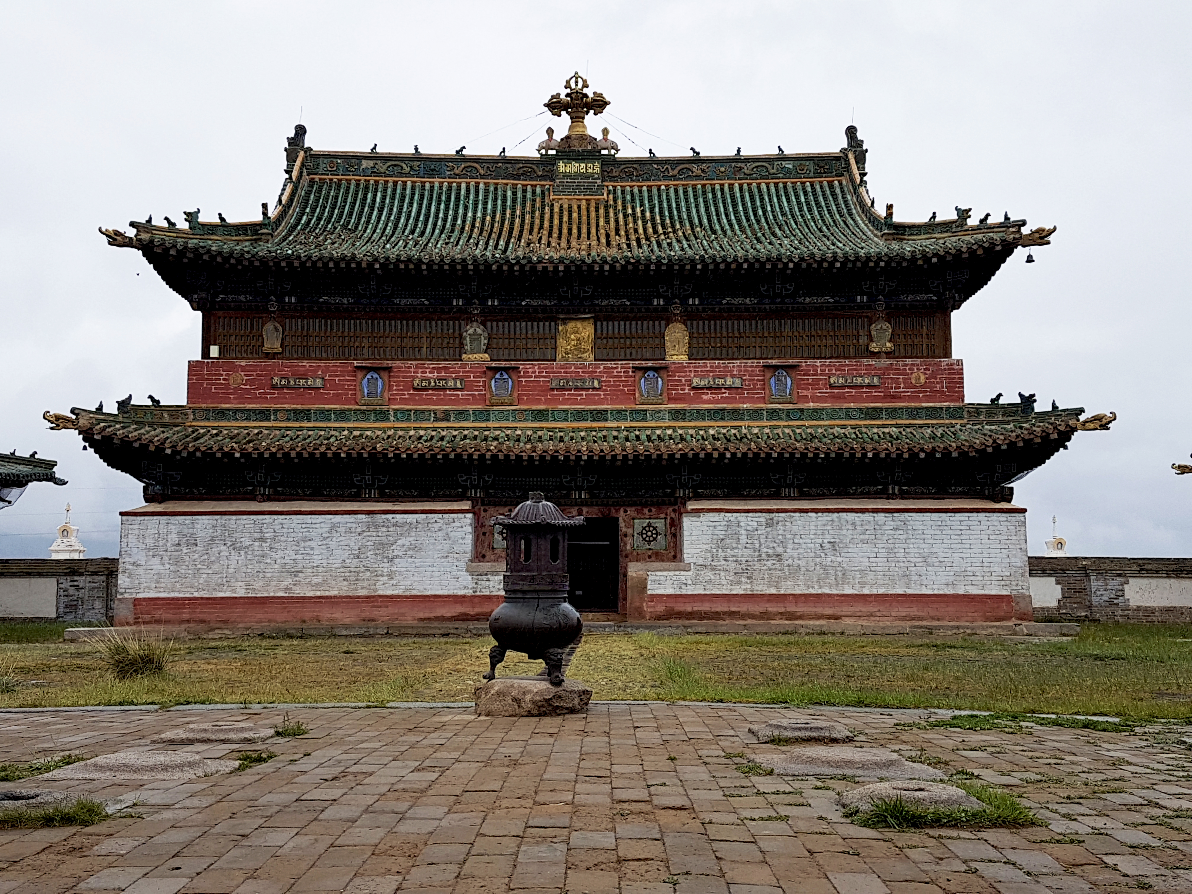
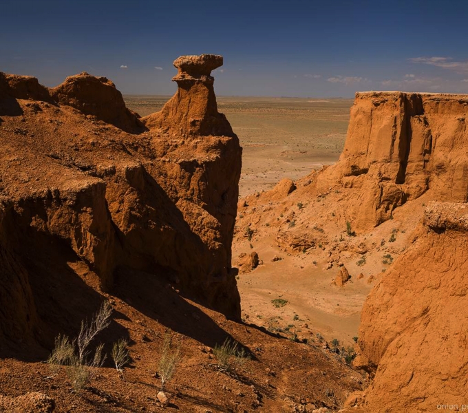
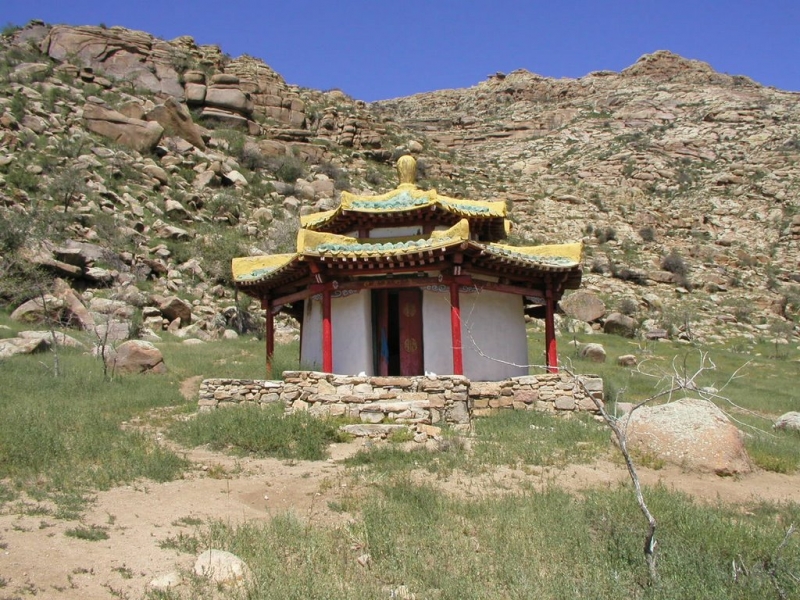
Yoliin Am
In 1965, before the creation of Gurvan Saikhan National Park, a small 69 square kilometers area around Yoliin Am Canyon was already a protected area. Yoliin Am is located about 60 kilometers Southwest of Dalanzadgad, in the mountains of Züün Saikhan. The bearded vulture, Yol in Mongolian, gave its name to the Yoliin Am Valley, the Gorge of Bearded Vultures.
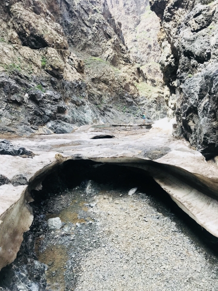
Located at a height of 2500 meters, Yol Canyon forms a gorge that is so deep and so narrow, that only two persons can pass in some places. The water forms four small waterfalls. Although the sun shines a lot in this region, the canyon remains dark, so that at the bottom, a part of the river remains nearly all year long covered by a thick layer of ice.
Here, travelers can discover permanent glaciers, endemic plants, and rare animals such as Siberian ibex, argali, or bearded vultures. Snow leopards and other predators also live in the Yol Valley area.
North of the massif, dinosaurs’ skeletons dating back from more than 70 million years, have been found.
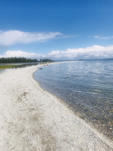
Khuvsgul Lake
At 1645 meters above sea level, Lake Khövsgöl is a really small sea that extends 136 kilometers long, 36 kilometers wide, and 267 meters deep. It contains 2 % of the world’s freshwater reserves (480,7 km3). It is named “the blue pearl of Mongolia” because of its very clear water, so clear that we can drink it. It’s the second largest lake of Mongolia, after Lake Uvs which is located in the West of the country. Lake Khövsgöl and its surroundings are a protected natural area.
It’s the pressure of the same tectonic forces as the gigantic Lake Baikal, located 195 kilometers towards the North, in Siberia, that formed Lake Khövsgöl. A river network binds the two lakes. That’s why we named Lake Khövsgöl “Baikal’s little brother”. The water will have to flow on more than 1000 kilometers after leaving Khövsgöl before flowing into Baikal.
Almost one hundred rivers flow into Lake Khövsgöl. Lake Khövsgöl flows into the Eg River and the Eg River flows into Lake Baikal. The lake is surrounded by a dozen peaks covered with pine forests that reach more than 2000 meters at their highest point.
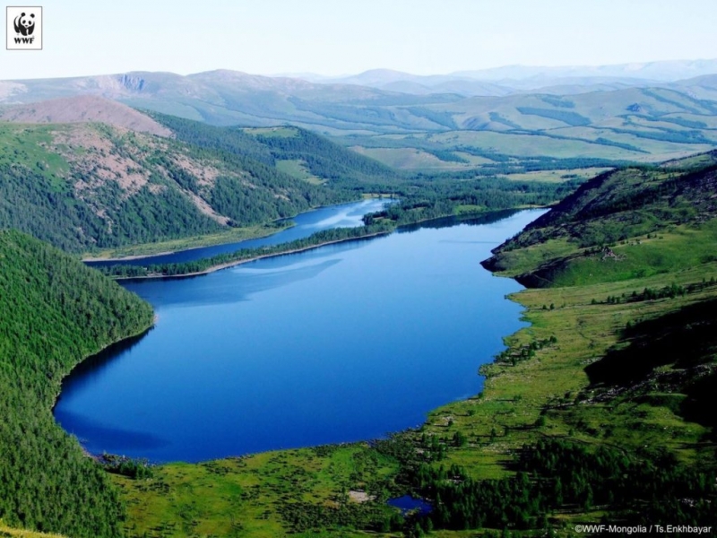
Terkhiin Tsagaan Nuur Lake
Lake Terkhiin Tsagaan Nuur, ”White Lake of the Terkh River”, is located 2060 meters above sea level. It’s the jewel of Arkhangai and one of the most beautiful lakes in the country. The eruption of Khorgo Volcano explains the presence of the lake. Besides, it’s surrounded by other extinct volcanoes. It extends 16 kilometers long and 4 to 10 kilometers wide. It covers an area of 61 square kilometers (23.55 square miles), and its average depth is 20 meters. We can find many pikes and many other species of fish. The lake remains frozen for a big part of the year. This area is still wild; you may see chital, marsh deer, wild boars, ducks, or great cormorants.
In the Khorgo – Terkhiin Tsagaan Nuur Natural Park, we can also see and make the ascent of Khorgo Volcano that is an extinct volcano reaching its highest point at 2240 meters, located east of Terkhiin Tsagaan.
This easy 16-kilometer hike will lead you to the summit of this extinct volcano covered with basalt that was active 8000 years ago. Its crater measures 200 meters in diameter and 70 to 80 meters in depth, and it is surrounded by small copses of trees. It has been protected since 1965. Around Khorgo Volcano, there is a remarkable area, made of solidified lava bubbles; the locals name this place ”the basalt yurts”.
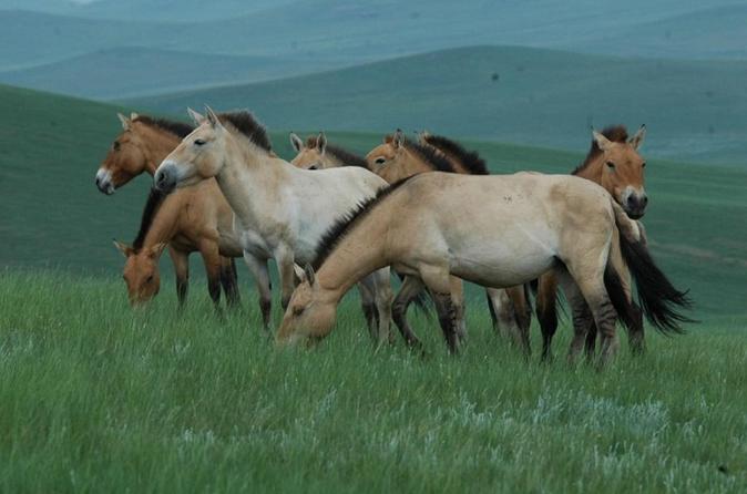
Khustai National Park
Khustain Nuruu National Park, whose name means ”the range of silver birches”, is located 90 kilometers Southwest of the capital, 1843 meters above sea level in the sum of Altanbulag. It’s lined by Avdar Mountain in its Western part.
When this natural reserve was created in 1992, it covered an area of 506 square kilometers. Then, in 1998, it became a national park covering an area of 500 square kilometers to reinsert the Przewalski’s horse, ”Takhi” and to protect the ecosystem of the forest-steppe, extremely threatened by the overexploitation of the land. It houses 459 species of plants, 85 species of lichens, 90 species of mosses, 33 species of mushrooms, and 44 species of mammals live in this area, such as the red deer, Mongolian gazelle, roe deer, gray wolf, lynx, and red fox.
We can also see in the park 217 species of birds, such as the golden eagle, bearded vulture, great bustard, whooper swan, black stork, and partridge. The reserve is composed at the same time of desert zones and mountainous zones.
Khongor Sand Dunes
Khongor dunes, ”Khongoriin Els”, are the most important sand mass of Gobi Gurvan Saïkhan National Park. Its area is more than 900 square kilometers. It’s one of the largest sandy areas of Mongolia. Suddenly standing out from the plains, they are undoubtedly among the most spectacular in the country. The wind continuously blows from North towards West and the dunes can reach breathtaking heights, between 100 and 300 meters at their highest points. Khongor dunes are more than 180 km long and can reach 27 kilometers wide. The inhabitants name their imposing dunes, ”singing dunes” due to the noise made by the wind when it moves the sand. Beyond the dunes, the steppe extends as far as the eye can see.
Khongor dunes have a particular appeal because they have an impressive combination of colors (the dunes are pale yellow). At the north, they are lined with a green and luxuriant vegetation band, delimited by a river: Khongoriin Gol. Supplied by subterranean sources, this little river flows along the dunes for a few kilometers and forms an oasis in the middle of the dried landscape.
This area is also very rich in dinosaur fossils and mineral deposits.
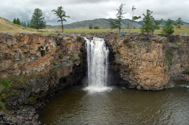
Orkhon Valley and Orkhon Fall
Orkhon Valley is located North of the province of Ovorkhangai, in the central part of Mongolia, about 360 kilometers Southeast of Ulan Bator. Located at the foot of the Khangai range, this site has been protected by UNESCO since 1992 and covers 121.967 hectares along the Orkhon River. A buffer zone of 61.044 hectares is protected too.
The basin of the Orkhon River has many historical vestiges because many successive nomads have been living in the valley since the prehistoric period. This area is often considered the cradle of the nomadic civilization of the steppes and was a real forum of civilizations during the last millennium because it bound east to west in the middle of the large Eurasian continent.
In the centuries, many nomadic tribes lived in Orkhon Valley. The first proof of living was found on the sites of Moiltiin Am and Orkhon-7 and allows us to think that the valley was inhabited 60.000 years ago. We can also visit many monasteries, such as Erdene Zuu Monastery which is the oldest Buddhist monastery in Mongolia, Tovkhon Hermitage, or Shankh Monastery. All these places show the religious traditions of the Mongolian nomads.
Today, Orkhon Valley is a large place where many nomads usually set up their camps. The picturesque steppes’ landscapes, surrounded by the verdant Khangai Massif, the rich fauna and flora, make this area the perfect place to discover the nomadic Mongolia in an enchanting leafy setting. It’s also very pleasant to ride horses and the valley is the point of departure for many hikes or treks in the surrounding mountains. It’s possible to fish or to bike in the mountains.
Khugnu Khaan
Khugnu Tarna National Park is located 250 kilometers from Ulan Bator, on the road to Kharkhorin. Covering an area of 47000 hectares, this park contains many historical monuments, forests of silver birches and poplar trees, and sources. The ecosystem of this park is particularly interesting because the steppe and the taiga meet here. So, we can find fauna and flora that are characteristic of these two ecosystems, and also some wonderful landscapes, with the granite formations of Khugnu Khaan. Created in 1997 as a natural reserve, it became in 2003 a natural park, that is to say, an area protected by the State for its educative, historical, cultural, or environmental value. The sacred mountain of Khugnu Khan is a venerated mountain located along the edge of the borders of Uvurkhangai, Bulgan, and Tuv province.
Venerating the mountains is a tradition that comes from prehistoric times. Today, the mountains are venerated during national or local ceremonies. Anyone visiting a sacred mountain must bring something as an offering and will probably make a wish for the attention of the Spirit of the Mountain. We can’t climb a sacred mountain without any precise and important aim.
Kharkhorin
Chinghis Khan's legendary city was founded in 1220 in Orkhon Valley, on the Silk Road. In 1235, his son Ogoodei built the city and raised around it a surrounding wall with four doors. The Mongolian Empire was governed from this city until Khubilai Khaan settled the capital in Beijing.
Kharkhorin (Karakorum in English) was at the same time a political, economic, administrative, and religious center and one of the largest forums of civilizations. The surrounding wall of the city surrounded a 400-meter square area. The city had four stone turtles, some are still visible.
As far back as the 8th century, Mongolian people deified the turtle. It symbolizes longevity, solidarity, and independence, and it's the animal of the spirit of water. That's why four turtles were set in Kharkhorin, to keep off floods and ensure eternal life.

The city was destroyed by Ming troops in 1380. A few relics remain, notably two granite turtles, the base of a palace, some stone lions, two columns, and a few traces of an irrigation channel. The site has been protected since 1961. In the ruins of Kharkhorin, archaeologists discovered 230 coins coming from around ten different countries.
Tsenkher Hot Spring
There are in Arkhangai many old volcanoes, which explains the presence of this hot water source that flows all year long at 1860 meters above sea level in the sum of Tsenkher. The water is at 85,5°C.
In a pleasant verdant wooded area, some yurt camps with equipment and baths with a less hot temperature have been set up for the travelers, but also for the nomads and the inhabitants of Ulan Bator who are very keen on these baths. Tsenkher hot springs have healing properties notably on particular diseases and nervous system diseases. Composition: sodium carbonate, hydrocarbonate, sulfate, fluorite, hydrogen sulfide.
Ugii Nuur
Lake Ugii is located 1337 meters above sea level, in the Eastern Arkhangai. It is 7.9 kilometers long, 5,3 kilometers wide, and covers an area of 25 square kilometers. Its maximum depth is 15.3 meters, but more than half the lake is less than 3 meters deep. It's a very fish-rich lake (pikes, perches, carps, bur bots, stone loaches, etc.) and an important place where migratory birds usually stop. The local inhabitants consider the lake as a place of worship.
Many yurts camps are settled on its banks and it's possible to rent canoes. Fishermen and fisherwomen will enjoy casting their fishing rods in the waters of the lake.
Naiman Nuur
Naiman Nuur National Park is located in the province of Ovorkhangai, in the Khangai range, and it has the typical landscapes of the Mongolian high mountains with their large forests of larches.
The area of Naiman Nuur, ”Eight Lakes”, formed behind the volcanic eruptions that occurred all along the centuries. The park is 2400 meters above sea level. An area of 11.500 hectares has been protected as a National Park since 1992.
The lakes are located about 35 kilometers Southeast of Orkhon waterfalls, but the track is impassable. This way is accessible only to hikers and horsemen/women who will enjoy exceptional nature, whereas the jeeps will have to skirt around the mountains by Bat Ulzii, or even by the track to Khujirt in case of heavy rain.
The eight lakes in question are lakes Shireet, the largest and the most beautiful, Khaliut, Bugat, Khaya, Khuis, Onon, Doroo, and Bayan Uul. Two of the smallest lakes are completely dry, and the second largest lake, Khuis Nuur, is 90% dry.
The national park is located in a high mountains area comprising alpine meadows and forests of conifers (Siberian pines and Siberian larches). In the North of the protected area, we can see entire valleys strewn with volcanic stones. The peaks of the mountains are arid.
The place is very cool and there can be snowstorms in June or August. In the heart of Summer, temperatures rarely go until 20°C during the day. 400 to 500 millimeters of rainfall each year.
Inside the national park, we can see 50 species of birds, such as the black-throated loon, great cormorant, bar-headed goose, or whooper swan.
Bayanzag Flaming Cliffs
Bayanzag red sand cliffs, today better known as “flaming cliffs” due to their colors ochre and red, are located about 100 km northwest of Dalanzadgad. This thorny shrub measuring approximately two meters high proliferates in the surroundings and is a good source of food for camels.
This plain has many sedimentary sand cliffs where many dinosaur fossils have been found. In 1922, the paleontologist Roy Chapman Andrews was the first to discover dinosaurs’ bones and eggs. They belonged to a horned, herbivorous, two-meter-long dinosaur that was not identified yet. After this discovery, this dinosaur was called Protoceratops Andrews. The excavations lasted two years, during which many hundreds of bones were dug up. During this period, Andrews and his team discovered a dinosaur’s nest with an egg’ clutch. This discovery drew the whole world’s attention.